Drone LiDAR & Photogrammetry Survey for Commercial Property
Project Snapshot
Sector: Commercial Property & Construction
Service: Drone LiDAR Surveys & Photogrammetry
Equipment: UAV with LiDAR and High Resolution RGB Payload
Challenge: Overcoming terrestrial scanner line of sight limitations to capture complex roof structures, while providing both highly accurate CAD data and accessible visual, digital site planning tools.
Deliverables: Web-Hosted 3D Photogrammetry Model, 2D CAD Elevation Drawings, CAD Roof Plans
The Challenge
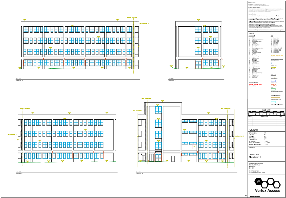
A major national contractor required highly accurate, as-built 2D CAD elevations and roof plans for a large commercial office block in Leeds prior to a planned renovation project. They also needed a way to visually assess the site and plan logistics remotely.
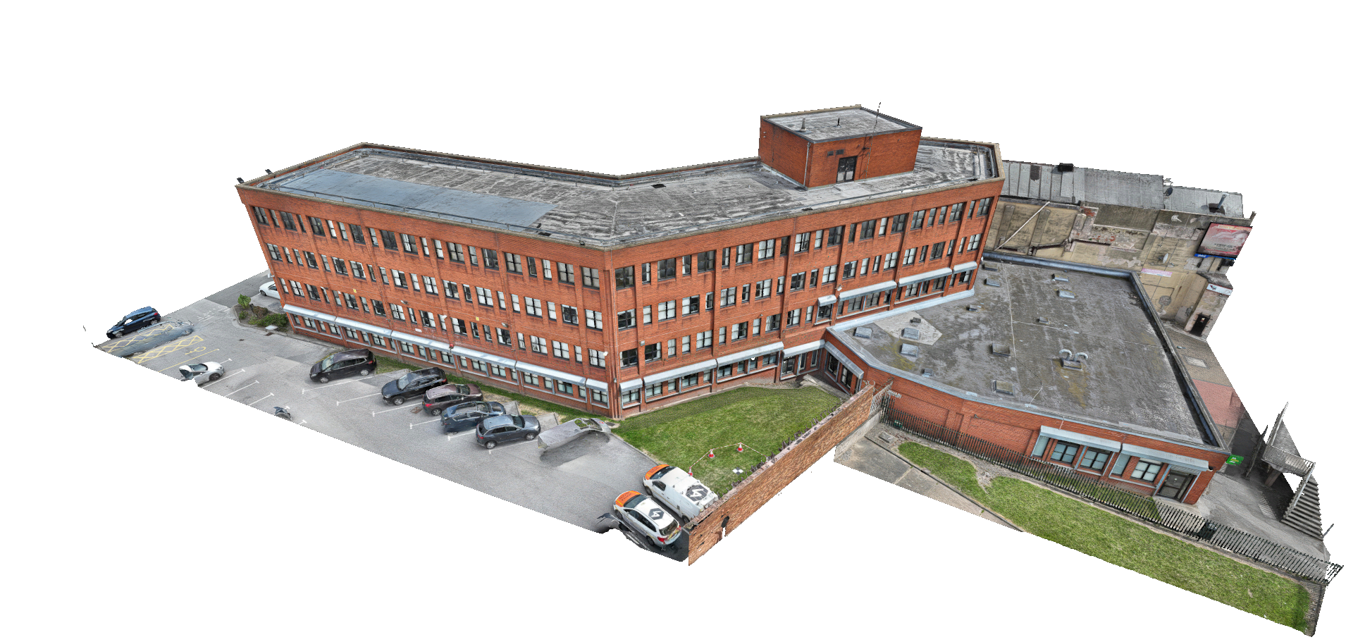
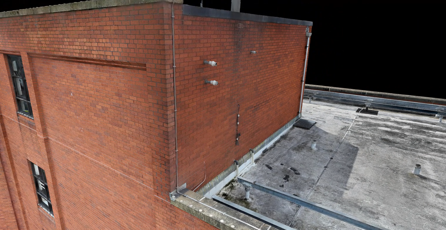
The building featured a multi-level flat roof housing a perimeter mansafe track system, a suspended maintenance winch, and detailed brickwork façades. The primary challenge for data capture was line of sight. Traditional ground-based terrestrial laser scanners could easily capture the lower levels, but they were physically unable to see the flat roof structure or accurately map the highest points of the elevations from the street.
Relying solely on standard drone photogrammetry from above presented a different issue; while excellent for visual context, photogrammetry software frequently struggles to accurately reconstruct the thin, metallic roof structures (like mansafe rails and winches) required for precise CAD design work.
The Vertex Solution
To overcome the line-of-sight limitations of ground scanners and provide the perfect deliverables for different project stakeholders, Vertex Air deployed a hybrid aerial survey utilising both high-resolution photogrammetry and LiDAR.
First, we flew automated grid patterns capturing high-definition overlapping imagery. This visual data was processed into a 3D photogrammetry model and hosted on a secure web-based viewer. This provided the client's project managers with an easily accessible, intuitive digital twin to plan works, assess access routes, and take approximate measurements from the comfort of their office, all without needing specialist software.
Next, we executed a secondary flight using our LiDAR payload to capture the true geometry of the building. This easily mapped the intricate roof tracks, the winch system, and the parapets with absolute precision, providing the robust dataset needed for the design phase.
The Result
By splitting the deliverables, Vertex Access provided exactly what each team required.
The interactive photogrammetry model streamlined site planning and logistics, reducing the need for physical site visits. Meanwhile, our CAD specialists utilised the highly accurate LiDAR point cloud to extract precise measurements, producing flawless 2D roof plans and full elevation drawings. The client's engineering team was equipped with the reliable foundational data required to execute their renovation project safely and efficiently.