Confined Space Drone Survey & Inspection Services
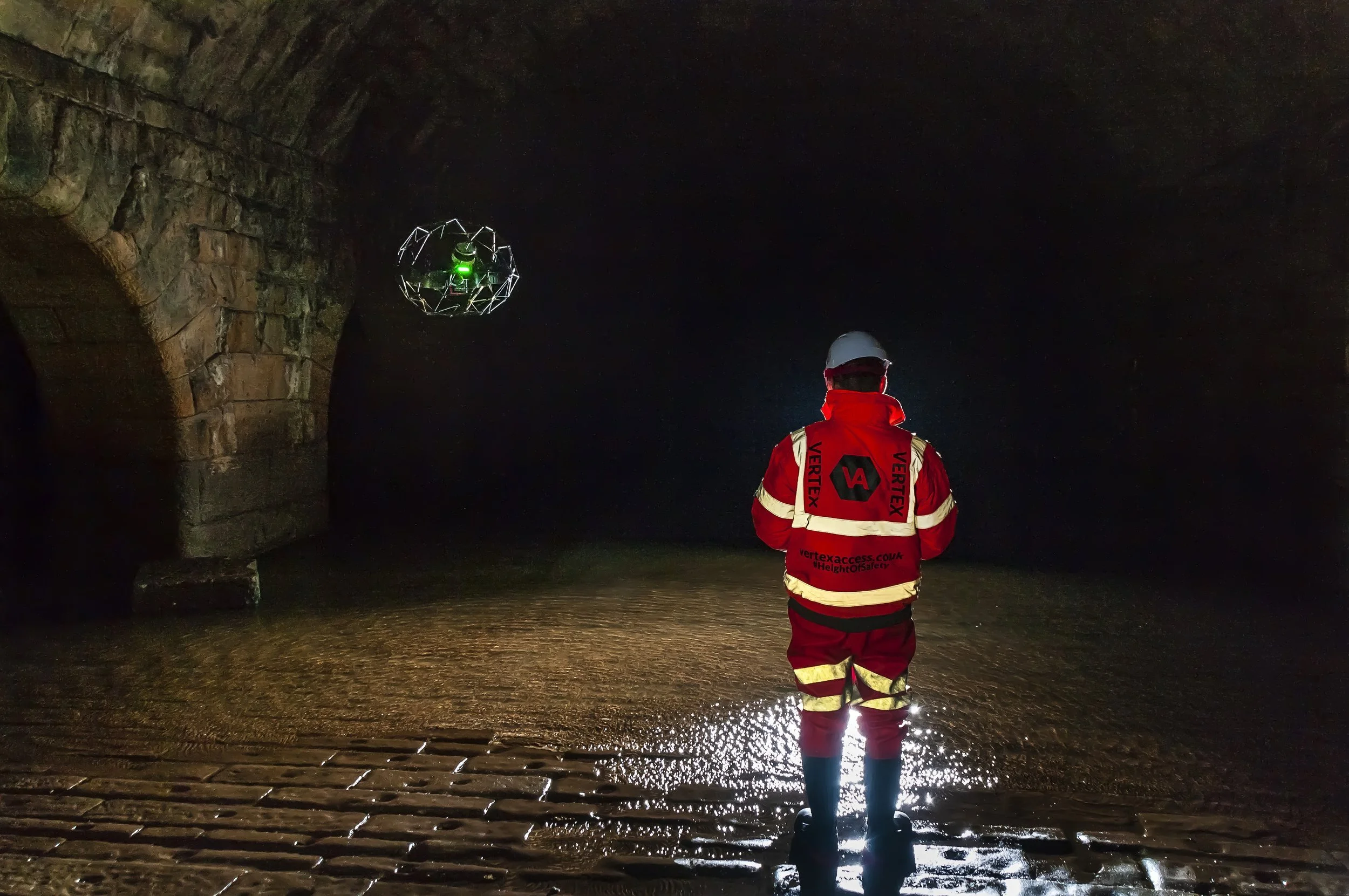
Vertex Air provides specialist internal inspection services for complex, hazardous, and inaccessible assets across the UK. Deploying the Flyability Elios 3 alongside advanced LiDAR, thermal, and ultrasonic testing payloads, our survey teams eliminate the requirement for confined space entry delivering comprehensive, actionable data from assets that would otherwise demand significant operational downtime, permit to work procedures, and risk to personnel.
Our Confined Space Drone Capabilities
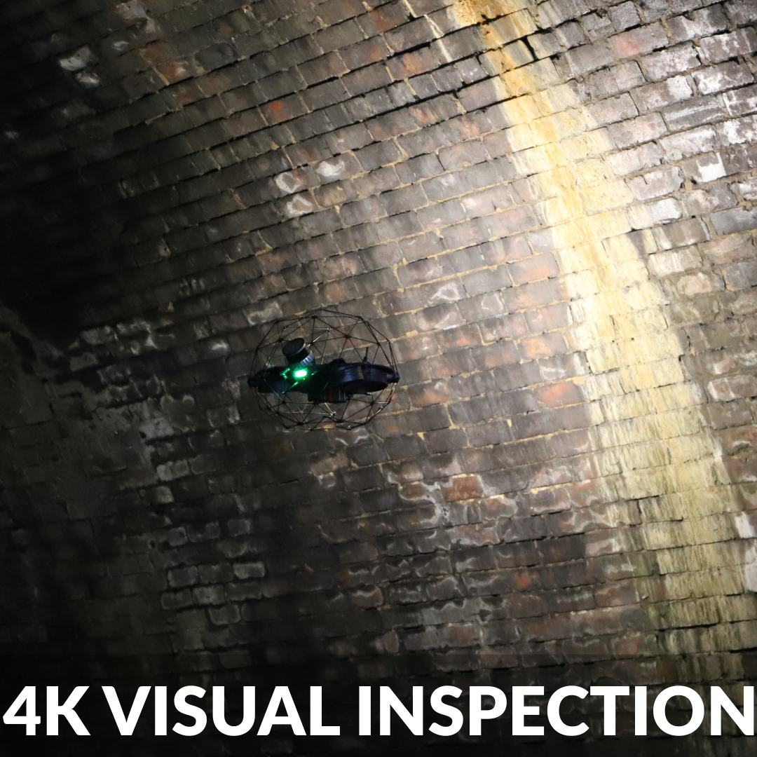
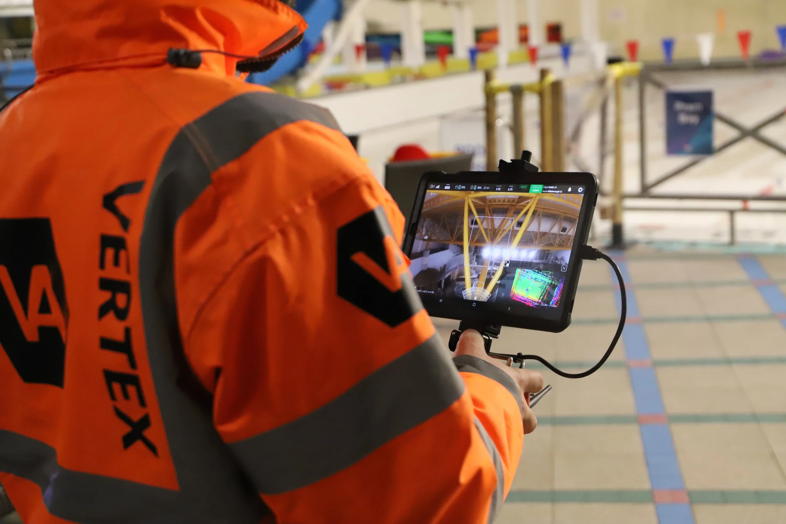
High-resolution 4K imagery captured across a 180° field of view, supported by a 16,000 lumen LED lighting array. Suitable for detailed condition assessment in completely unlit environments including deep culverts, storage tanks, and structural voids.
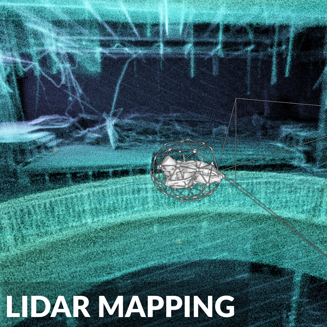
Accurate 3D point cloud data generated using the Elios 3 LiDAR survey payload and SLAM technology. Produces georeferenced models suitable for CAD integration, BIM workflows, and structural measurement without ambient light or GPS signal. Drone Internal LiDAR Survey
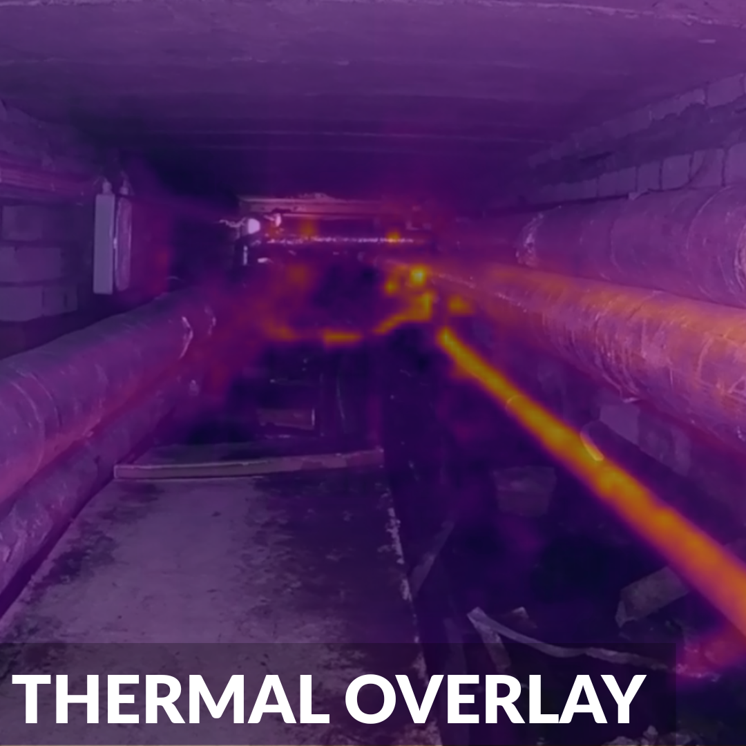
Radiometric thermal cameras deployed alongside visual sensors to identify hidden leaks, moisture ingress, heat anomalies, and structural defects in completely dark or hazardous internal environments.
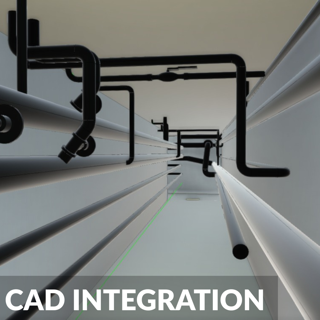
Survey data delivered in formats compatible with existing CAD and BIM workflows, including point cloud files, orthomosaics, and geo-referenced condition imagery.

Continuous atmospheric monitoring for up to 14 explosive and toxic gases including LEL and H2S, providing real time hazard mapping throughout the survey without requiring personnel to enter the asset.
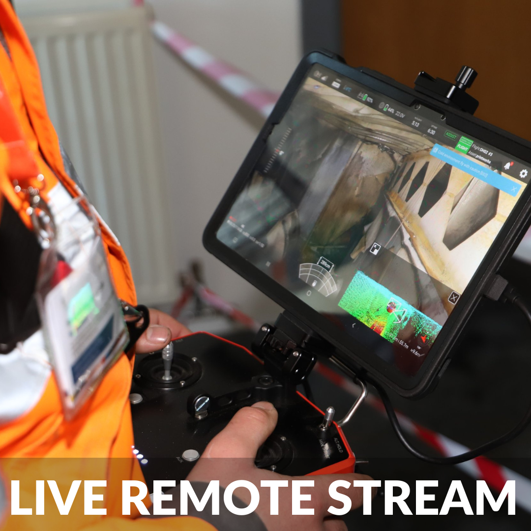
Encrypted live feed streamed directly to engineers and asset managers in a designated safe zone, enabling collaborative, real-time decision making throughout the survey operation.
A More Effective Approach to Confined Space Assessment
Traditional confined space inspection requires extensive pre-entry planning, dedicated rescue teams, breathing apparatus, atmospheric testing, and permit to work systems, all before a single observation can be made. For assets in continuous operation, this process carries both significant cost and programme risk.
Vertex Air's drone led approach fundamentally changes this. Our survey teams deploy the Flyability Elios 3 from outside the asset, capturing comprehensive visual, LiDAR, thermal, and atmospheric data without any requirement for human entry during the initial inspection phase. The result is a complete condition dataset, delivered faster, at lower cost, and with no exposure of personnel to hazardous atmospheres or structural risk.
All confined space drone surveys are planned and executed by experienced survey professionals. Our teams include STE4 qualified examiners for culvert and structural assessments, IRATA certified rope access specialists where hybrid operations are required, and geospatial survey technicians for LiDAR data processing and BIM integration. Every deployment is underpinned by site specific RAMS, CAA operational authorisation, and comprehensive public liability and professional indemnity insurance.
Advanced Technology - The Elios 3
The Elios 3 is the industry's leading platform for internal drone inspections. Purpose-engineered for complex confined environments, it is the only commercial drone system capable of navigating unlit, GPS-denied spaces with the precision and stability required for professional condition assessment.
Collision resilient carbon fibre cage An omnidirectional protective cage allows the drone to make contact with internal surfaces without loss of control, enabling close up inspection of components inaccessible to conventional drones.
IP44 ingress protection Rated to withstand dripping water, spray, and heavy dust, ensuring reliable operation in wet culverts, sewer networks, and industrial environments regardless of internal conditions.
LiDAR assisted stability Advanced vision sensors combined with LiDAR stabilisation maintain complete positional control in total darkness and internal air movements, producing consistently crisp imagery and accurate spatial data.
16,000 lumen LED lighting Fully illuminates pitch black internal environments, ensuring no area of the asset falls outside the survey scope regardless of depth or complexity.
Recent Projects

Confined Space Assets We Survey
Vertex Air undertakes confined space drone surveys across a wide range of asset types. Each presents distinct operational challenges, our survey teams are experienced across all of the following and carry the specific technical knowledge each asset type demands.
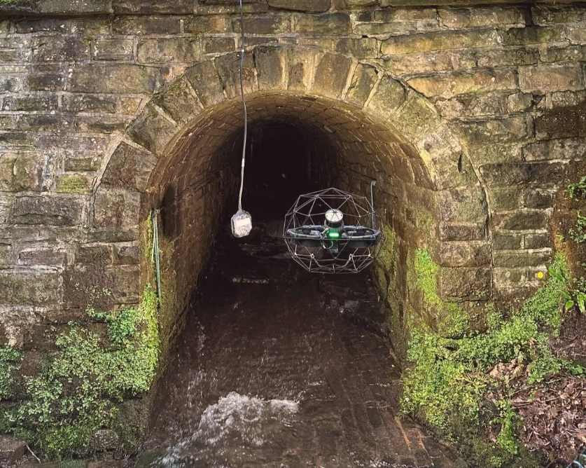
Culverts and drainage infrastructureCondition assessment and LiDAR mapping of culverts from accessible entry points, including assets with complex geometry, direction changes, and restricted clearance. Our STE4 qualified examiners provide structural assessments to the standards required by highways and infrastructure authorities.
Sewer networks Visual condition surveys and structural assessments of live and offline sewer networks for water utilities, local authorities, and infrastructure contractors.
Tunnels Internal inspection of railway, highway, and pedestrian tunnels including visual condition survey, LiDAR mapping, and defect reporting with minimal or no operational shutdown required.
Storage tanks and vessels Full internal inspection of bulk storage tanks, pressure vessels, water reservoirs, and silos, including ultrasonic testing and tether supported operations for deep vertical structures.
Industrial chimneys Visual condition surveys and ultrasonic thickness testing of industrial chimney structures, flue linings, and refractory materials using the Elios 3 with tether capability where the asset profile is suitable.
Bridge voids and internal structures Inspection of box girders, internal bridge voids, abutment chambers, and bearing shelves where physical access is impractical or unsafe.
High-level internal inspections Internal drone surveys of atrium roofs, high-level industrial pipework and drainage systems, roof voids, and other elevated internal environments where conventional access methods would require MEWPs or temporary works.
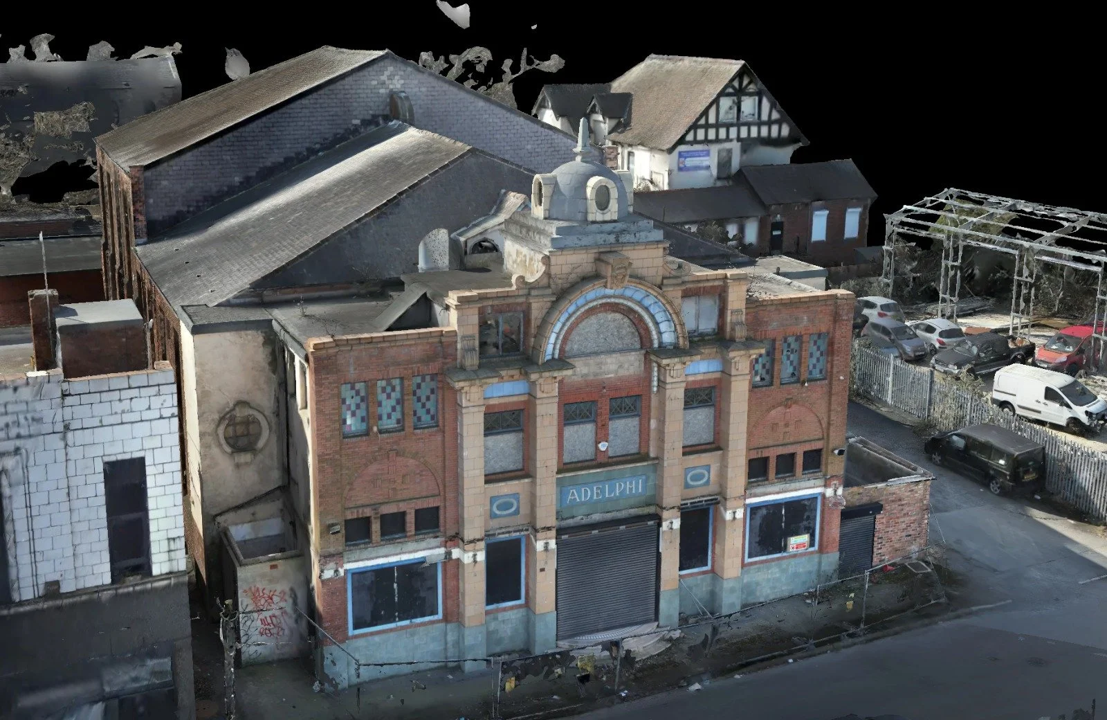
Hazardous and dilapidated structures Drone based condition assessment of fire damaged, structurally compromised, abandoned, or otherwise unsafe structures where human entry carries unacceptable risk. Commonly instructed for insurance assessment, structural appraisal, and pre-demolition survey purposes.
Where precise geometric data is required alongside condition assessment, our drone internal LiDAR survey service is available across all of the above asset types. → Drone Internal LiDAR Survey
Sectors We Serve
Vertex Air delivers confined space drone inspection services across the following sectors. Where sector-specific experience, qualifications, or operational protocols are relevant, our teams carry the appropriate knowledge and credentials.
Civil infrastructure and transport Detailed visual inspections and LiDAR mapping for railway tunnels, culverts, highway bridge voids, and other transport infrastructure assets without disrupting live operations.
Utilities and water management Structural assessments of sewer networks, clean water reservoirs, aqueducts, and water treatment infrastructure for utilities operators and their supply chains.
Power generation and energy Remote visual and LiDAR surveys of industrial chimneys, boiler internals, cooling towers, penstocks, and hydroelectric infrastructure. Ultrasonic testing available for thickness and corrosion assessment.
Maritime Internal inspection of ship tanks, ballast spaces, exhaust vents, and void spaces using the Elios 3 with tether capability and ultrasonic testing payload. Structural condition assessment and corrosion mapping without dry-docking or confined space entry.
Mining and subsurface Stability mapping and condition assessment of ventilation shafts, ore passes, and abandoned underground workings in GPS-denied, total-darkness environments.
Industrial and manufacturing Rapid internal inspections of bulk storage tanks, pressure vessels, silos, and complex pipework networks without requiring ventilation procedures or production shutdown.

Elios 3 Tether Solution
For vertical and contained assets including storage tanks, silos, and certain industrial chimneys, Vertex Air deploys the Elios 3 tether system, providing continuous power supply for extended survey operations and an additional layer of operational safety in critical environments.
Where conventional confined space drone operations are constrained by battery life, the tether solution removes that limitation entirely for applicable asset types, allowing complete and uninterrupted internal surveys of deep vertical structures. Vertex Air is currently the only onshore UK operator to have this capability, providing clients in the energy, industrial, and utilities sectors with a survey option that combines the precision of the Elios 3 with operational endurance not available elsewhere.
The tether solution is deployed for vertical and contained assets. For assets with complex internal geometry including culverts, tunnels, and bridge voids, our standard Elios 3 configuration with range extenders is the appropriate deployment method.
Ultrasonic Testing Integration
In addition to visual, LiDAR, and thermal survey capabilities, Vertex Air can deploy an ultrasonic testing payload alongside the Elios 3 for assets where wall thickness measurement and corrosion assessment are required without internal entry.
Ultrasonic testing from a confined space drone platform is particularly relevant for storage tanks, industrial vessels, pipework networks, chimney structures, and marine assets where material degradation is a primary concern. Data is captured and reported by qualified inspection personnel, providing engineering-grade thickness measurements and corrosion mapping as part of a single mobilisation.
This capability is particularly valuable for clients in the power generation, marine, water utilities, and industrial manufacturing sectors.
Drone Led Survey with Human Entry Capability
Vertex Air takes a drone-first approach to confined space inspection, maximising safety and minimising operational disruption at every stage. However, we recognise that not every asset is suited to a fully remote survey, and that some inspection findings will require physical follow-up.
Where an asset's geometry makes a complete drone survey impractical, or where initial survey data identifies the need for tactile inspection, our teams work directly alongside the IRATA-certified confined space entry and rope access specialists at Vertex Access. This allows us to engineer a precise, targeted human entry based on the drone's 3D map of the asset, significantly reducing the scope, duration, and risk associated with any physical entry that follows.
The result is a single, coordinated operation rather than two separate contractor mobilisations, with the drone survey informing and mitigating risk for any subsequent human activity.
Survey Deliverables
Every confined space drone survey conducted by Vertex Air produces a defined set of deliverables, tailored to the scope and requirements of the project. Standard outputs include:
Condition report — a structured written assessment compiled by qualified survey personnel, including an executive summary, defect schedule with categorisation and priority recommendations, and annotated imagery.
High definition video — 4K video walkthrough of the full survey extent, suitable for client review, stakeholder reporting, and insurance documentation.
Still imagery — high-resolution images of all identified defects and points of interest, with spatial location data embedded for precise asset management records.
3D LiDAR point cloud — where the LiDAR payload is deployed, a fully processed point cloud delivered in LAS, LAZ, E57 or RCS format, compatible with CAD, BIM, and GIS software.
Atmospheric monitoring data — gas concentration records for all monitored compounds throughout the survey duration, providing a complete atmospheric safety log for the asset.
CAD drawings and BIM models — available on request, produced by our geospatial specialists from LiDAR data to engineering-grade accuracy.
-
No. Because our pilots operate the drone safely from outside the confined space, there is zero human entry required during the initial survey phase. This completely eliminates the need for standby rescue teams, breathing apparatus, and complex permit to work systems associated with physical human entry.
-
The Elios 3 uses a robust wireless transmission system. While range depends heavily on the layout and materials of the asset (for example thick concrete versus steel), we utilise range extenders and specialised antenna cables that can be dropped into shafts or fed through manholes to ensure strong signal penetration deep into complex structures.
-
Yes. The drone is equipped with a 16,000 lumen LED lighting array that easily illuminates pitch black environments like sewer networks and storage tanks. Furthermore, the LiDAR scanner and SLAM technology do not require ambient light to navigate or map the environment, allowing our survey teams to build precise 3D models in total darkness.
-
Depending on your project requirements, we provide high definition 4K video walkthroughs, high resolution still imagery of specific defects, radiometric thermal reports, live gas monitoring data, and highly accurate 3D point clouds (LAS or LAZ formats) that can be imported directly into your CAD or BIM software.
-
The exact accuracy of our indoor 3D models depends entirely on your specific project, the surrounding environment and the geometry of the asset. Because confined spaces require SLAM technology rather than GPS, accuracy can vary from site to site. We always consult with you beforehand to evaluate your asset and ensure the data we capture will meet your exact engineering requirements, whether you need general spatial awareness, volumetric calculations or specific structural measurements.
-
Currently, there are no commercially available inspection drones that hold full ATEX certification due to their exposed motors and batteries. However, Vertex Air heavily mitigates this risk through strict safety protocols. We can utilise our atmospheric gas monitoring payloads to test the environment first, or work alongside your site managers to ensure the asset is fully purged and vented before our pilots commence the flight.
-
A major advantage of our service is the sheer speed of deployment. While a traditional physical entry might require days of scaffolding erection, ventilation, and rescue team preparation, our specialist pilots can often complete a comprehensive drone survey in a single day or even just a few hours. This drastically reduces your operational downtime and keeps your facility running smoothly.