Drone Roof & Building Survey Services
Expert aerial inspections for commercial, industrial and historic properties. Our qualified building surveyors deliver safe, efficient data capture and detailed condition reports without the need for scaffolding.
Comprehensive Building Survey Capabilities
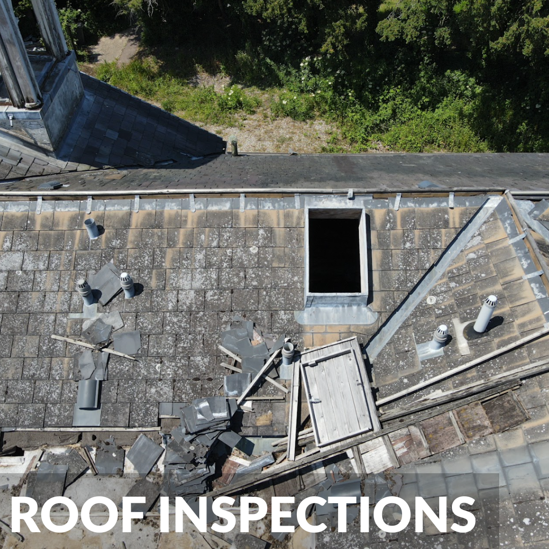
Capture detailed 4K photography and video of pitched roofs, flat roofs, and chimneys that are completely invisible from ground level.
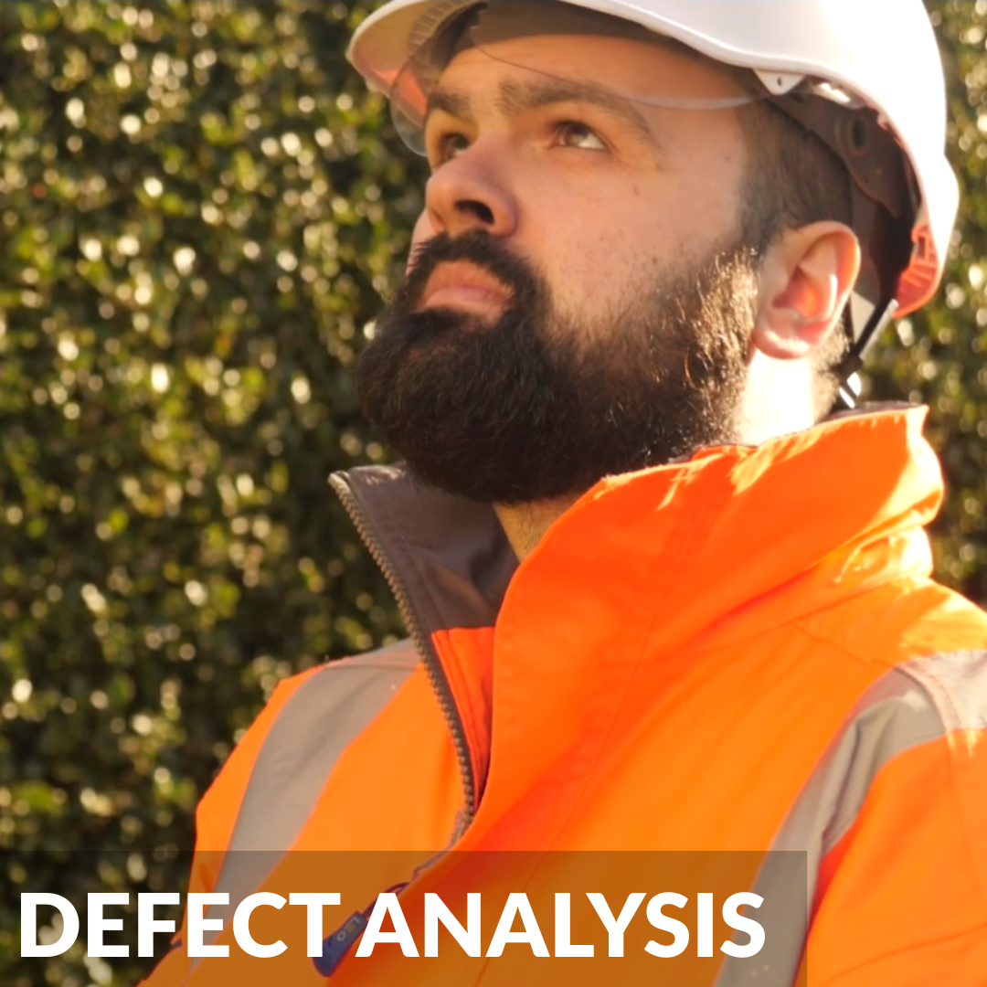
Our qualified building surveyors analyse drone data to provide detailed, referenced condition reports complete with repair recommendations.
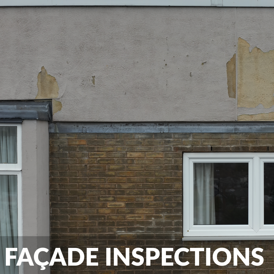
Safely assess brickwork, render, and cladding across high rise structures without deploying rope access teams or cherry pickers.
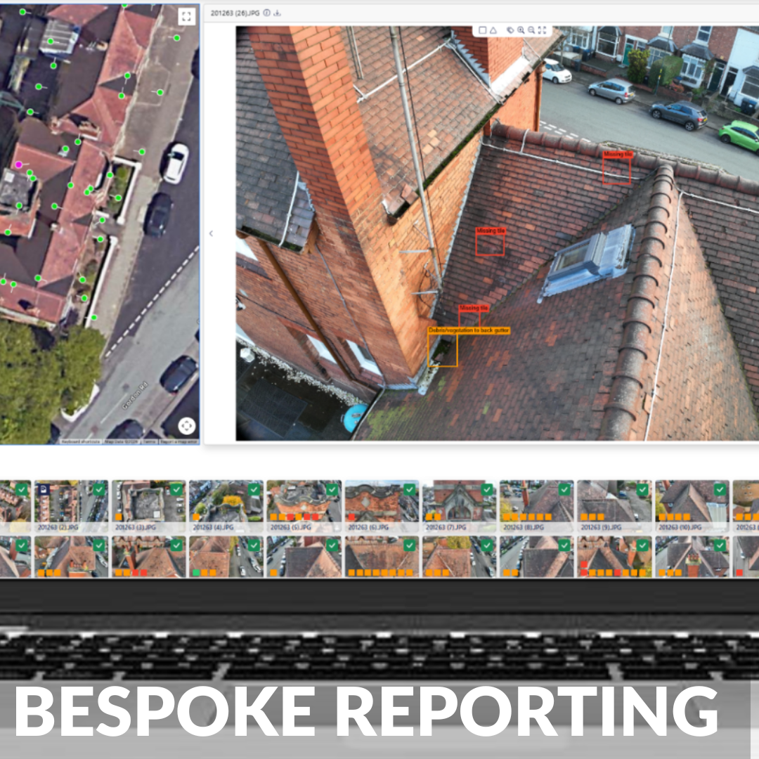
We utilise our custom, in house developed building survey software, delivering tailored defect reporting to suit your project.
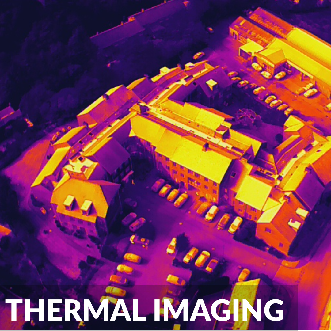
Utilise radiometric thermal cameras to detect hidden defects such as flat roof water ingress, missing insulation, and severe heat loss.
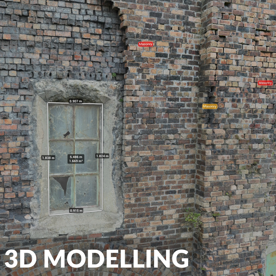
Convert aerial imagery into highly accurate 3D models and digital twins, providing the perfect foundation for PPM scheduling.
Vertex Air: Drone Roof & Building Surveys
Vertex Air operates at the forefront of commercial aerial surveying, providing highly accurate, reliable, and comprehensive condition data for the built environment. Whether you require a flawless defect report for a dilapidation claim or a complete 3D digital twin to streamline a complex retrofit, Vertex Air delivers the survey-grade intelligence you need to proceed with absolute certainty.
We believe that effective property management requires perfect data. Working closely with facility managers, building surveyors, and landlords, we provide tailored aerial solutions to overcome any site's unique logistical and environmental challenges.
A Safer Approach to Building Envelope Surveys
Traditional roof and façade inspections often require expensive scaffolding, powered access machinery, and present significant safety risks for personnel working at height.
Vertex Air provides a modern, highly efficient alternative. Backed by over a decade of commercial flight experience, our specialist pilots safely deploy advanced drones to capture crystal-clear imagery of your entire building envelope. This completely removes the risks associated with working at height and provides our in-house Building Surveyors with the exact data they need to produce comprehensive, actionable defect reports.
Unmatched Expertise & Advanced Technology
We do not just hand you a folder of raw photographs. Vertex Air combines strict aviation standards with genuine building pathology expertise:
Qualified Building Surveyors: Your data is expertly interpreted by our in-house surveyors. They possess the technical knowledge to correctly identify, categorise, and report on complex building defects.
Advanced UAV Fleet: Our pilots utilise sophisticated drones equipped with powerful optical zoom lenses and radiometric thermal sensors, allowing us to capture extreme close-up details safely.
CAA Approved Operations: Vertex Air holds full operational authorisations from the Civil Aviation Authority, allowing our teams to conduct flights legally and safely, even in highly congested urban environments.
Vertex Group: From Survey to Remediation
Vertex Air operates as part of the wider Vertex Access group to offer a seamless, end-to-end property solution. The detailed data from our drone surveys directly informs the targeted repair strategies delivered by our sister companies. Whether you require Vertex Roofing to replace defective slates, Vertex Facades to maintain high-level cladding, or Vertex Rope Access to conduct complex physical repairs, we provide a smooth transition from accurate inspection to specialist remediation.
Serving Diverse Property Needs
We provide consistent, reliable condition data across multiple sectors, minimising disruption to your daily operations:
Commercial & Industrial Facilities: Rapid surveys of vast factory roofs and retail parks while your site remains fully active.
Historic & Listed Buildings: Highly sensitive, non-destructive survey methods avoiding physical contact with fragile structures.
Facilities Management Portfolios: Standardised data across multiple assets for highly effective budget forecasting and PPM planning.
Residential Estates & High-Rise Blocks: Comprehensive condition insights for landlords, efficiently identifying defects across tower blocks.
-
Yes. As a fully accredited commercial operator, Vertex Air holds Specific Category permissions from the Civil Aviation Authority (CAA). This allows our highly trained pilots to legally and safely conduct building surveys in congested urban environments and city centres.
-
You will receive a comprehensive, easy to understand digital report authored by our qualified building surveyors. It includes high resolution imagery of every identified defect, a detailed description of the issue, condition ratings and practical recommendations for remedial works.
-
No. Because our drones operate entirely in the airspace above your property, we completely remove the need for local authority pavement permits, road closures or scaffolding licenses. This saves you significant time and administrative costs.
-
While we always maintain a safe standoff distance to protect your asset, our drones are equipped with powerful optical zoom lenses. This technology allows our pilots to capture millimetre accurate details of hairline cracks, loose mortar and missing fixings from a safe vantage point.
-
A major benefit of aerial surveys is the speed of data capture. While erecting scaffolding can take days or even weeks, our pilots can typically survey an entire commercial building envelope in a matter of hours, allowing your site to remain fully operational without disruption.
-
While our commercial drones are exceptionally robust, aviation safety regulations and the need for crystal clear imagery dictate that we cannot fly in heavy rain or high winds. Our operations team constantly monitors local aviation weather forecasts and will proactively work with your site managers to schedule the survey during optimal conditions, ensuring the data we capture is perfect.
-
Vertex Air operates strictly within the guidelines of the Information Commissioner's Office and the Civil Aviation Authority regarding data protection. Our cameras are focused entirely on the structural envelope of the building. Any incidental imagery captured, such as individuals on the ground or the inside of occupied office windows, is securely managed and blurred where necessary to ensure total privacy compliance.