Confined Space Drone & LiDAR Survey for Underground Culvert Inspection
Project Snapshot
Sector: Infrastructure & Utilities
Service: Confined Space Drone Surveys
Equipment: Confined Space Drone with LiDAR Payload
Challenge: 115m unmapped, hazardous culvert with limited clearance, fast water flow, and signal loss.
Deliverables: Geo-referenced 3D Point Cloud, Visual Condition Survey
The Challenge
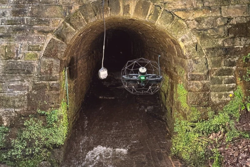
Vertex Air was tasked with conducting a comprehensive condition assessment and mapping the exact route of an underground culvert. Prior to attending the site, we had severely limited information regarding the structure's layout, other than an estimated length of 100m and narrow outlet dimensions of roughly 1.8m x 2.0m.
The culvert featured fast flowing water and incredibly low clearances, making traditional human entry highly hazardous. Furthermore, sharp elevation and direction changes deep within the structure meant drone signal strength was lost at the 75-metre mark during the initial flight from the outlet.
The Vertex Solution
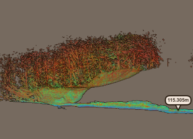
To overcome the signal loss without putting personnel at risk, our surveyors rapidly processed the initial LiDAR data on site. By comparing the 80m of captured 3D route data against Google Maps, we successfully pinpointed the exact location of the hidden inlet on the surface.
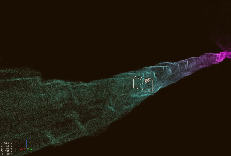
Our operatives relocated to the newly discovered inlet and continued the survey from the opposite side. Using FARO Connect, we confidently stitched the two separate point clouds together, relying on the distinct jagged rock faces and historic sprayed numbers on the walls to ensure a perfect overlap. Ground Control Points (GCPs) were established at both ends to ensure absolute geospatial accuracy.
The Result
We provided 100% survey coverage of the culvert without a single person ever being put in a position of danger. The survey revealed the true length of the structure was 115m, not the assumed 100m.
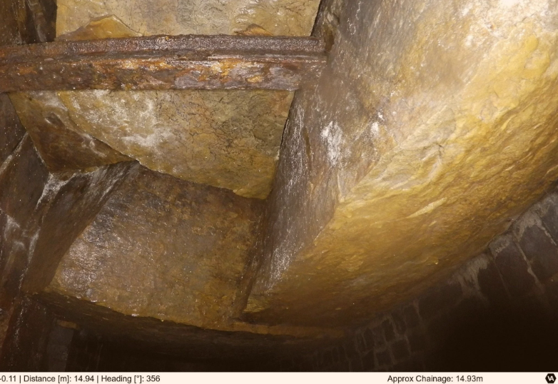
The client received a fully geo-referenced 3D point cloud ready for CAD integration, seamlessly tied into their above-ground topographical surveys. Alongside this, our condition surveyors delivered high-resolution still images with chainage and video footage, providing crucial structural information to facilitate safe, informed maintenance planning for the future.