3D Photogrammetry & Digital Twin of an Industrial Dust Extractor
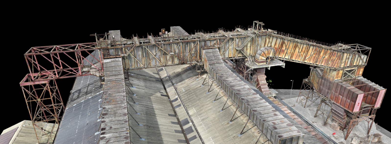
Scaled 3D Mesh
Project Snapshot
Sector: Industrial & Facilities Management
Service: Drone 3D Mapping & Digital Twins
Equipment: High Resolution Commercial Drones
Challenge: Complex steel geometry, restricted roof access, and harsh lighting conditions.
Deliverables: Dimensionally Accurate 3D Digital Twin, Interactive Web-Based Viewer
The Challenge
Our client required a comprehensive and dimensionally accurate 3D model of a large, historic dust extractor unit situated on an industrial roof. The primary goal was to create a permanent digital asset for remote inspections and maintenance planning, entirely removing the need for high-risk manual access.
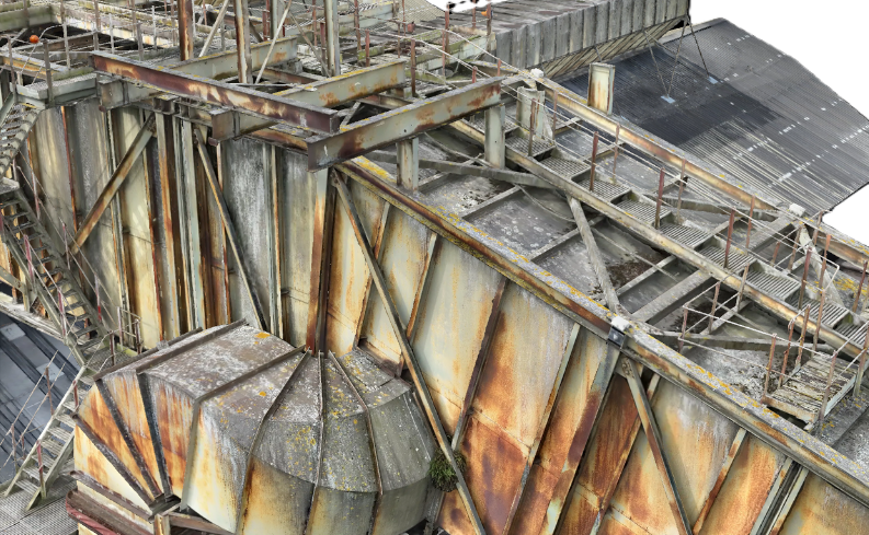
Capturing a perfect 3D model presented a unique combination of obstacles. The roof access was severely limited, the asset featured highly intricate steel geometry, and constantly changing lighting conditions threatened to disrupt the visual data required for accurate photogrammetry.
The Vertex Solution
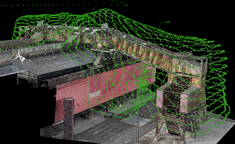
To overcome these obstacles and ensure 100% data coverage, our team engineered a multi-layered flight plan executed safely from the ground. This involved a combination of automated orbital flights at varying altitudes, paired with manual, targeted flights to capture the intricate details hidden in deep shadow.
We collected over 5,000 high-resolution aerial images. During post-processing, our geospatial specialists fine-tuned the parameters to neutralize the harsh shadows and highlights, allowing the software to seamlessly reconstruct the complex geometric elements into a clean, evenly lit, and stunningly accurate 3D model.
The Result
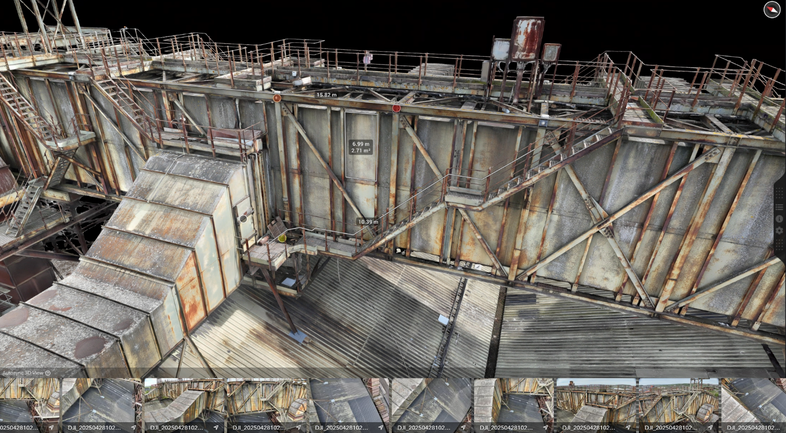
We delivered far more than just a 3D model; we provided a comprehensive, interactive asset management tool hosted on a secure web-based platform.
Without ever stepping foot on the dangerous roof, the client can now conduct virtual inspections from anywhere in the world panning, zooming, and rotating the model to inspect any component. The platform allows them to pull precise measurements for clearances and material quantities, and even upload new site-specific photos to tag defects directly onto the 3D model for future maintenance planning.