Drone LiDAR Survey for Commercial Rooftop Development in Central London
Project Snapshot
Sector: Commercial Development
Service: Drone LiDAR Surveys
Equipment: Commercial Drone equipped with Hovermap ST-X LiDAR Payload
Challenge: Capturing complex high level roof data in highly restricted Central London airspace to facilitate a rooftop restaurant conversion.
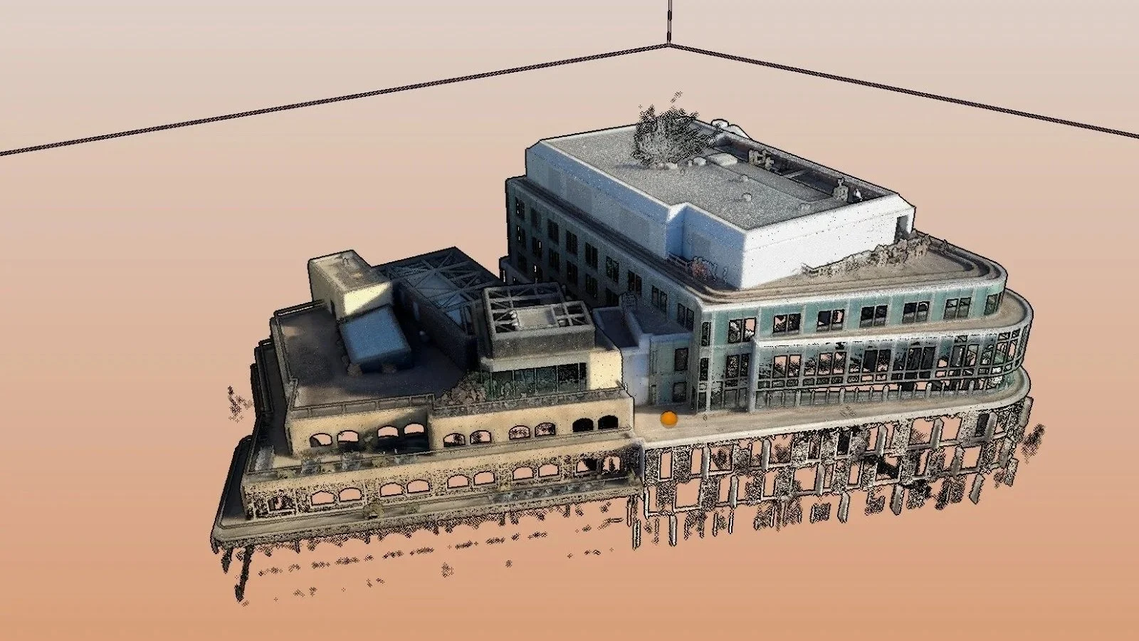
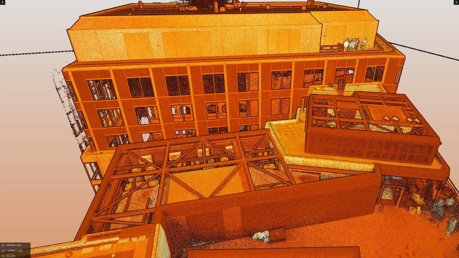
Deliverables: Geo-referenced 3D Point Cloud of High Level Elements
The Challenge
Our client was undertaking a commercial development project in the heart of Central London: removing heavy plant equipment from the top of a multi storey building to transform the space into a premium rooftop bar and restaurant.
To design the new venue and plan the safe removal of the existing machinery, the engineering team required accurate, high-level structural data. Traditional ground based surveying methods were completely unviable, as stationary laser scanners could not achieve the necessary line of sight to map the complex roof layout from street level.
Furthermore, the site's location presented a severe logistical hurdle. Operating in a high profile, densely populated area of Central London means navigating highly restricted airspace, requiring meticulous safety planning and coordination.
The Vertex Solution
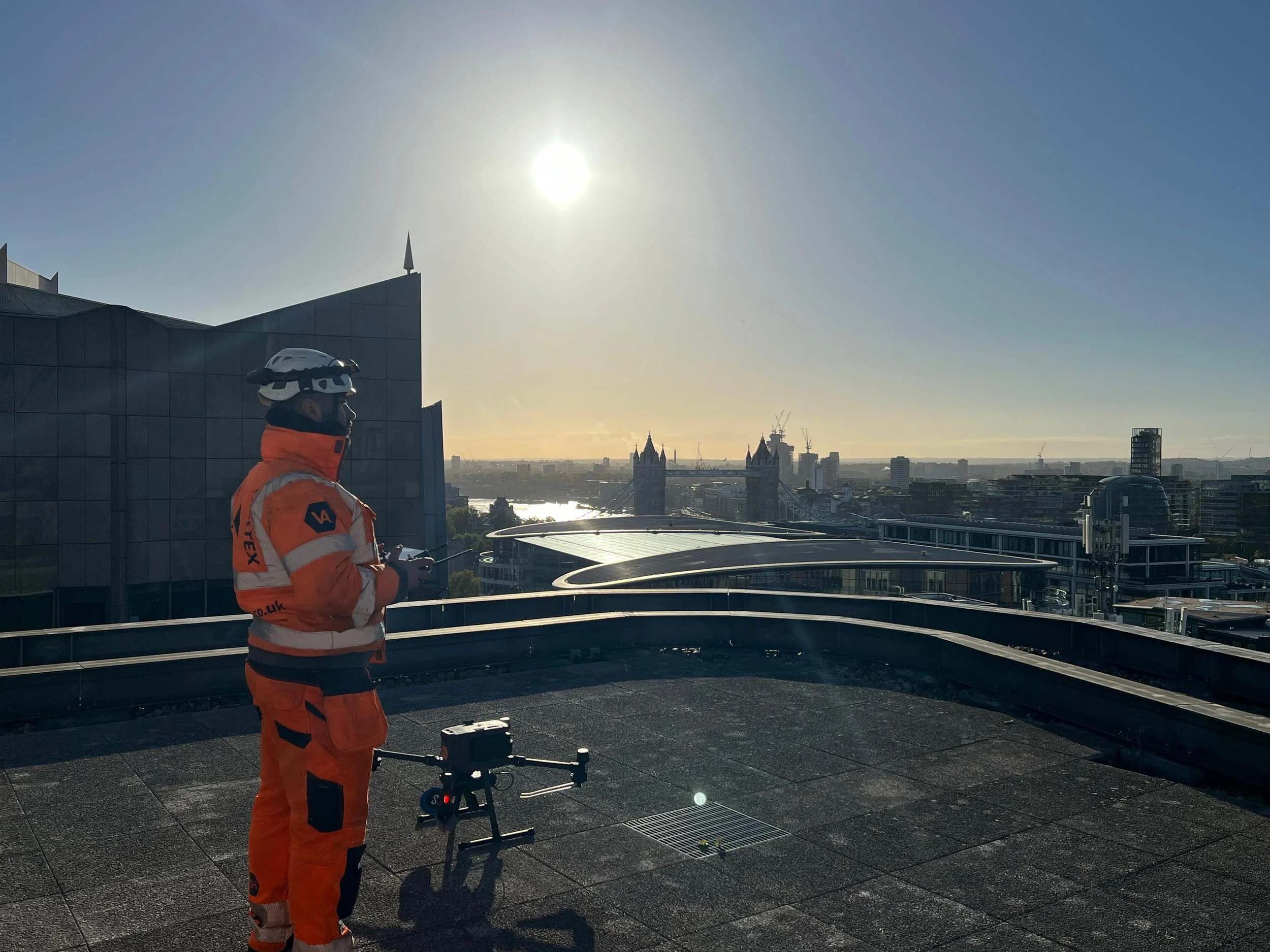
To overcome the line of sight issues and safely capture the roof's geometry, Vertex Air deployed a commercial drone equipped with our advanced Hovermap ST-X LiDAR payload.
Before a single propeller turned, our aviation compliance team tackled the complex logistics of Central London airspace. We drafted comprehensive RAMS (Risk Assessments and Method Statements) and liaised directly with all relevant local authorities, air traffic control, and stakeholders to ensure a safe, fully compliant, and legal flight operation in the busy urban environment.
Once airborne, the Hovermap ST-X sensor fired millions of light pulses to actively map the complex plant equipment and structural boundaries from above, completely bypassing the limitations of ground based scanners.
The Result
The flight was executed flawlessly with zero disruption to the surrounding public or traffic networks.
We delivered a highly accurate, geo-referenced 3D point cloud focusing specifically on the high-level roof elements. Crucially, our geospatial team ensured this new aerial LiDAR data integrated seamlessly with the client’s existing ground control and terrestrial data. The project engineers were equipped with a complete, reliable 3D model of the site, allowing them to confidently plan the plant removal and design the new rooftop hospitality venue.