Confined Space Drone & Photogrammetry Survey for Adelphi Theatre, Sheffield
Project Snapshot
Sector: Heritage Conservation & Construction
Service: Confined Space Drone Surveys & Digital Twin
Equipment: Rope Access deployment, Confined Space Drone with LiDAR, High Resolution Photogrammetry Drone
Challenge: Safely assessing the internal roof void and external structure of a highly dilapidated, unstable historic theatre to inform critical watertight repair works.
Deliverables: 3D External Photogrammetry Model, Internal Visual Video Footage, Internal 3D LiDAR Point Cloud
The Challenge
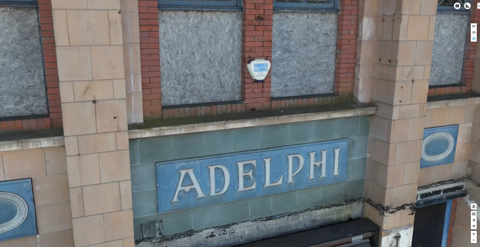
The historic Adelphi Theatre in Sheffield stood unoccupied and heavily dilapidated. The client's overarching project aim was to conduct essential repairs to make the building watertight and secure, ultimately preparing the asset for sale and a full, repurposed renovation.
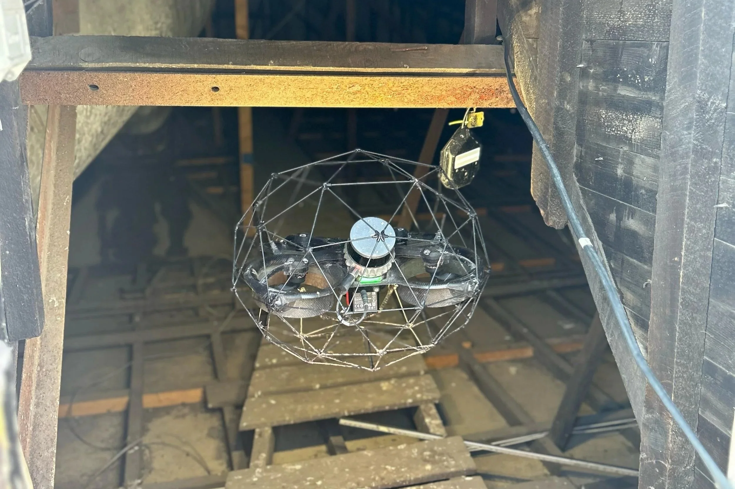
The primary obstacle for the planning phase was safe access. The internal structure—specifically the expansive and degrading roof void—was deemed entirely too unstable and hazardous for traditional human entry. Without accurate internal condition data and comprehensive external structural mapping, the client's engineering team could not safely or effectively plan the initial stabilisation works.
The Vertex Solution
To capture the required data without putting personnel at risk, Vertex Air deployed a multi-disciplinary approach, leveraging our cross-departmental expertise in both industrial work at height and advanced unmanned aerial systems.
To safely penetrate the hazardous roof void, our operatives utilised rope access techniques to reach a secure vantage point on an adjacent flat roof section. From this stable, external position, we deployed the Elios 3—a collision-tolerant confined space drone. The drone safely navigated the dark, unstable internal void, capturing high-resolution visual condition data and an accurate internal LiDAR scan without requiring a single person to step inside the dangerous structure.
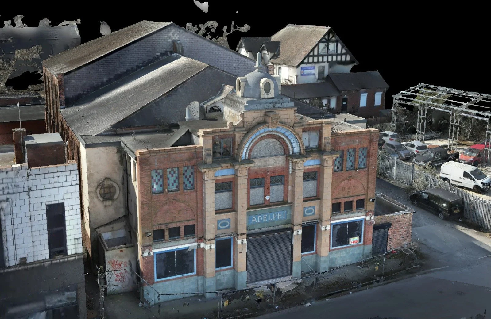
Concurrently, we conducted an external drone photogrammetry survey. We flew automated flight paths to capture the complex, degraded exterior façades and roof structures, translating thousands of high-definition images into a highly accurate digital twin.
The Result
The client was provided with a comprehensive digital dataset that bypassed all the structural hazards of the dilapidated site.
The internal LiDAR point cloud and visual footage allowed structural engineers to remotely assess the compromised roof void with total clarity. Simultaneously, the interactive 3D external photogrammetry model provided a vital, accessible planning tool for the client to coordinate the required watertight repairs and eventual sale of the Adelphi Theatre.