Drone Culvert Inspection & Survey Services
Vertex Air provides specialist drone based inspection and survey services for culverts across the UK. Using the Flyability Elios 3, our survey teams capture detailed visual condition data, LiDAR point clouds, and atmospheric readings from within culvert assets, eliminating the requirement for confined space entry and delivering comprehensive survey outputs to the engineers, asset managers, and contractors who depend on accurate culvert data.
The Challenge of Culvert Inspection
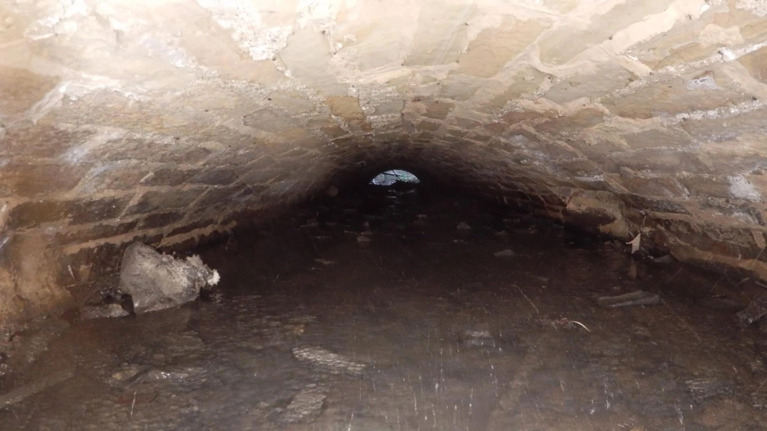
Culverts present some of the most demanding conditions in infrastructure inspection. Restricted dimensions, standing or flowing water, silt accumulation, poor air quality, and structurally compromised linings all contribute to an environment where conventional inspection methods, whether CCTV, physical entry, or pole camera, frequently reach their operational limits.
Where silt levels are too high for CCTV deployment, where water flow prevents safe physical entry, or where structural condition makes human access unacceptable, the result is often incomplete data, deferred inspection, or significant expenditure on temporary works just to gain access.
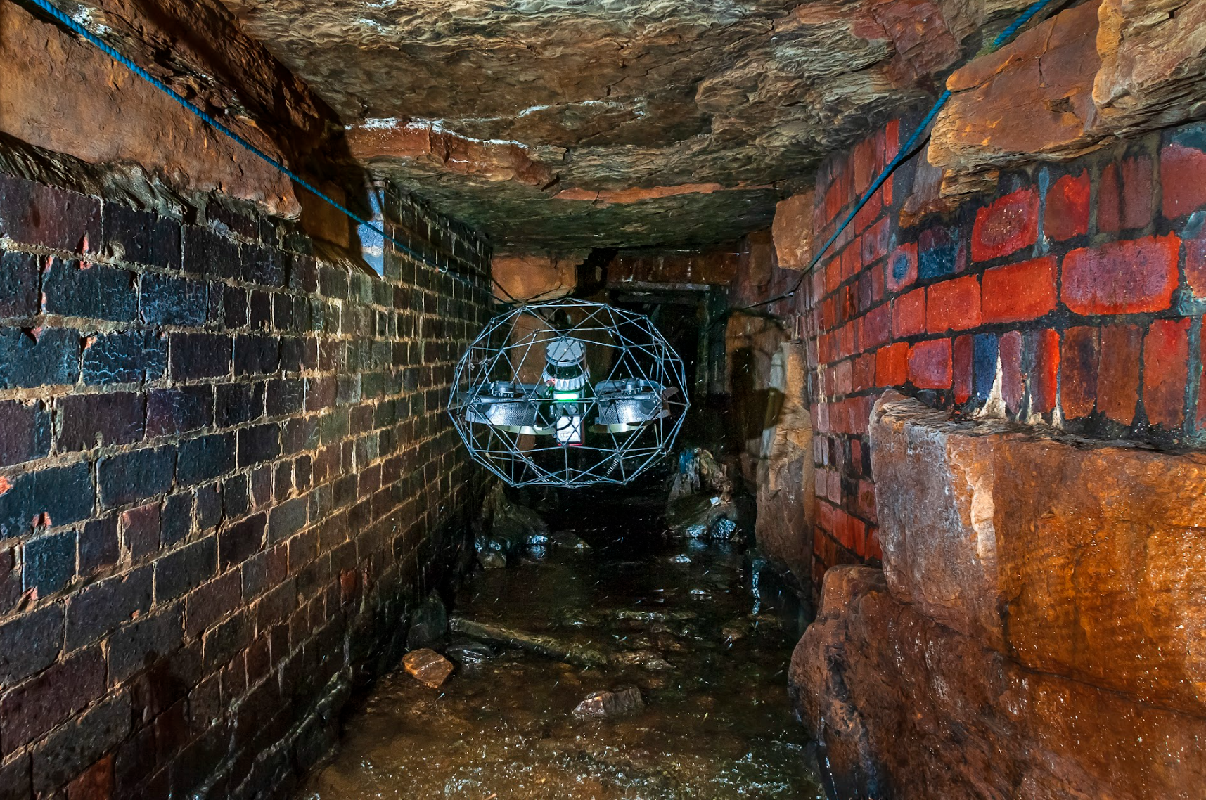
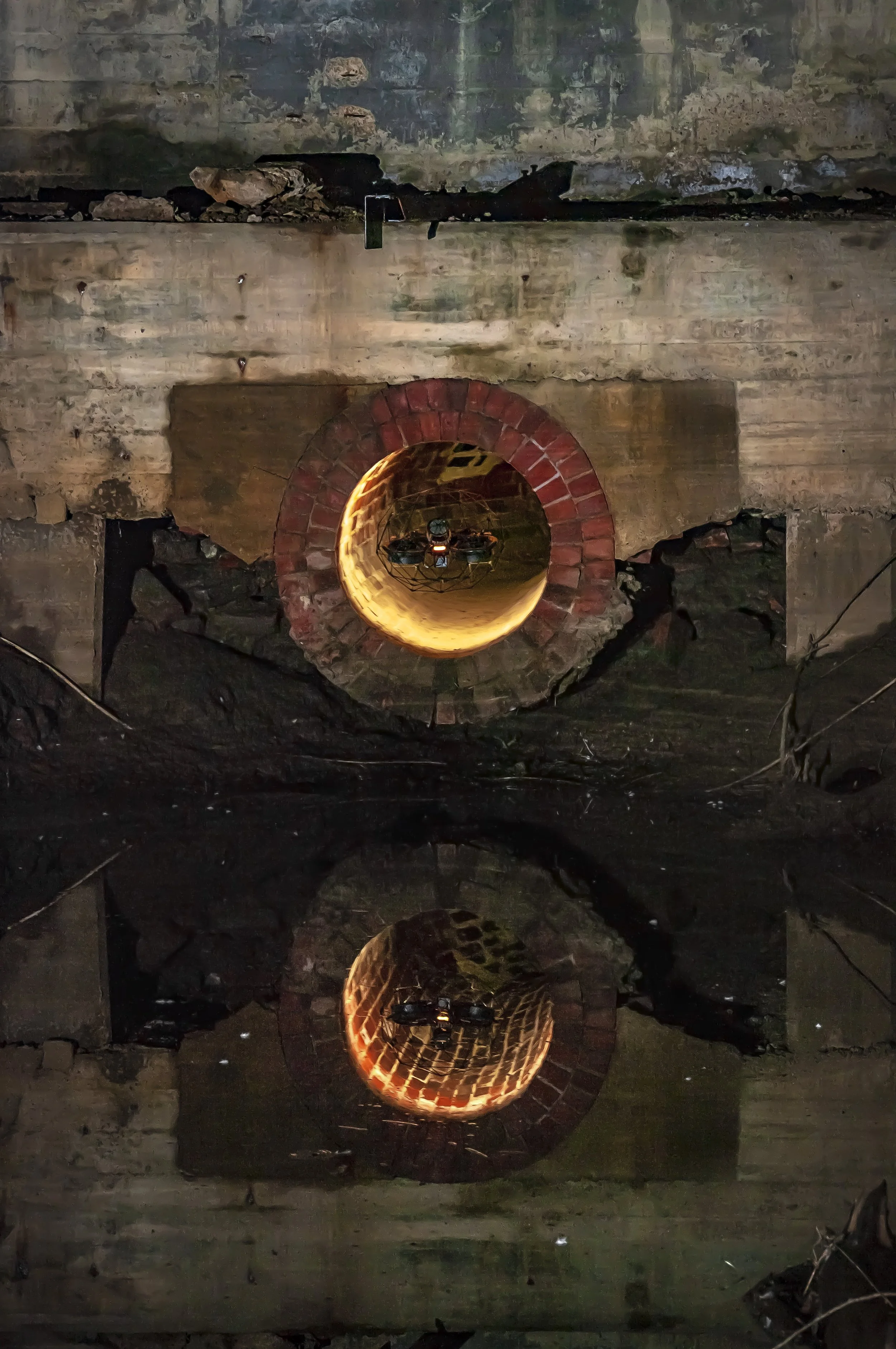
Drone inspection changes this. The Elios 3 navigates conditions that defeat conventional methods, flying over silt and shallow water, illuminating dark voids with 16,000 lumen LED lighting, and capturing data from the full extent of the culvert without any requirement for personnel to enter the asset.
What Vertex Air Delivers
Our culvert inspection service combines visual condition survey with LiDAR mapping in a single mobilisation, providing both the condition data needed for maintenance planning and the geometric data needed for structural assessment, capacity analysis, and alignment records.
Visual condition survey High resolution 4K imagery and video of the full culvert extent, captured under consistent LED illumination regardless of ambient conditions. All imagery is location referenced within the survey dataset, allowing defects and points of interest to be accurately located within the asset.
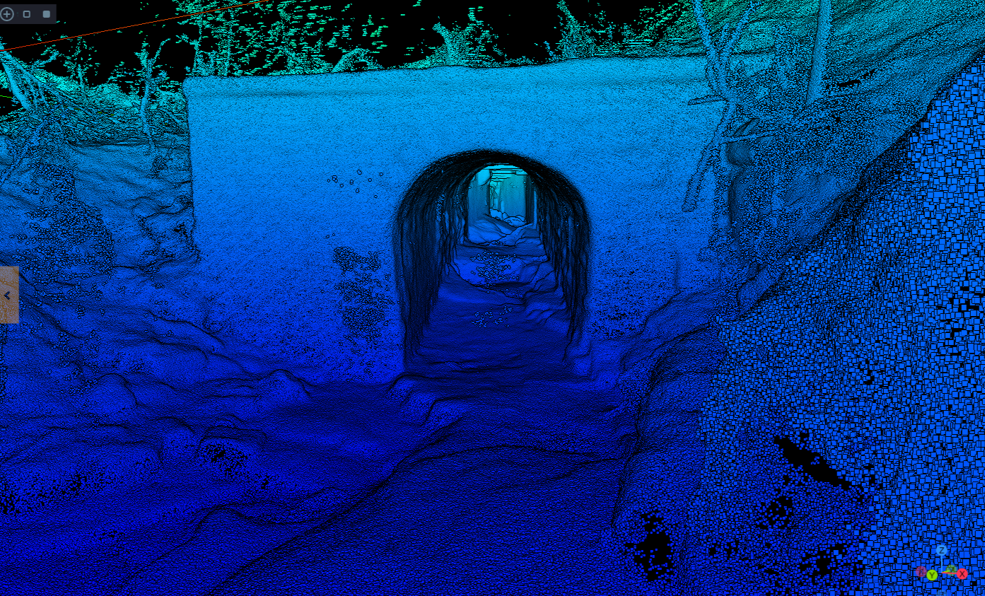
LiDAR mapping and dimensional data The Elios 3 LiDAR survey payload captures point cloud data of the culvert's internal geometry, producing accurate cross sectional profiles, longitudinal sections, and volumetric data suitable for CAD integration and structural analysis. This is particularly valuable where culvert dimensions are unknown or where deformation and settlement are suspected.
Atmospheric monitoring Continuous gas monitoring throughout the survey for up to 14 explosive and toxic compounds including LEL and H2S, providing a complete atmospheric safety record for the asset and informing any subsequent decisions regarding physical entry.
Condition reporting Survey findings are compiled by experienced inspection professionals into a structured condition report, including an executive summary, annotated defect schedule, and chainage referenced imagery. Where required, reporting can be structured to recognised infrastructure inspection standards.
Survey Deliverables
Every culvert inspection produces a defined set of outputs, agreed at project scoping stage:
Structured condition report — written assessment with executive summary, prioritised defect schedule, and annotated imagery suitable for maintenance planning and asset management records.
4K video walkthrough — full video record of the survey extent for client review, stakeholder reporting, and archive purposes.
Chainage referenced still imagery — high-resolution images of all identified defects and features with spatial location data.
LiDAR point cloud — point cloud in LAS, LAZ or E57 format, compatible with AutoCAD, Civil 3D, MicroStation, and other professional platforms.
CAD drawings — plan and section drawings derived from LiDAR data, produced to client specified scale and format where required.
Atmospheric monitoring — complete gas concentration record for the duration of the survey.
Who Instructs Culvert Surveys
Vertex Air's culvert inspection service is engaged by a broad range of clients, each with distinct data requirements:
Highways authorities and local councils — routine condition assessment and maintenance planning for highway drainage culverts, including assets where traditional CCTV is impractical due to silt or water levels.
Water authorities and utilities — structural and condition surveys of culverted watercourses, drainage assets, and associated infrastructure as part of planned maintenance programmes or reactive investigation following reported defects.
Rail and road infrastructure — inspection of culverts beneath operational rail lines and highway structures where access is restricted and survey windows are limited. Our inspection professionals carry the relevant competencies for working within managed infrastructure environments.
Ground investigation and geotechnical consultants — culvert condition and geometry data to support ground investigation reports, planning applications, and development feasibility assessments.
Home builders and developers — pre-development culvert surveys to establish condition, capacity, and geometry of existing assets affected by proposed development, supporting planning submissions and drainage strategies.
Main contractors and civil engineers — condition data and dimensional survey to inform design, specification, and construction planning for culvert repair, lining, or replacement schemes.
Other survey companies — specialist sub-contract capability for practices requiring drone-based culvert inspection and LiDAR mapping as part of a wider survey commission.
Operational Approach
Every culvert survey begins with a desktop review of available information, existing drawings, historical inspection records, asset registers, and any known constraints. This informs the survey plan, access strategy, and risk assessment before our team arrives on site.
On site, a point of work assessment is carried out before deployment. The Elios 3 is launched from outside the culvert at an accessible entry point, with the pilot operating from a safe position throughout. For culverts with multiple access points, the survey is typically completed from both ends to ensure full coverage, our teams use range extenders and specialised antenna systems to maintain reliable signal through complex or extended assets.
Where a culvert's dimensions, geometry, or condition present specific challenges, sharp direction changes, significant depth variation, restricted clearance, or partial blockage, our operators are experienced in adapting the survey approach to maximise coverage within the constraints of the asset.
Related Services
Culvert inspection frequently sits within a broader programme of drainage and infrastructure assessment. Where additional survey capability is required, Vertex Air provides:
Drone internal LiDAR survey — where precise dimensional data and location records are the primary requirement, our dedicated internal LiDAR survey service provides point cloud outputs across a range of inaccessible and confined assets.
Drone thermal imaging — UAV-mounted thermal surveys for subsurface leak detection in pipe networks and drainage infrastructure, identifying water loss and ground saturation from above.
Sewer inspection — specialist drone inspection services for sewer networks, covering visual condition assessment and structural survey.
Confined space drone surveys — our full internal inspection capability across all asset types, including visual, LiDAR, thermal, and gas monitoring.