
DRONE BRIDGE SURVEYS & INSPECTION
Revolutionising Bridge Inspections with Advanced Drone Technology
At Vertex Access, we are at the forefront of integrating advanced drone technology to conduct comprehensive and precise bridge inspections and surveys. Traditional bridge inspection methods can be costly, time-consuming, and often involve significant risks and disruptions. Our cutting-edge drone solutions offer a safer, faster, and more data-rich alternative, ensuring the longevity and safety of critical bridge infrastructure across the UK.
From detailed visual assessments to intricate LiDAR point clouds and high-resolution photogrammetry models, Vertex Access provides actionable insights for bridge owners, managers, and engineers.

Emergency Rail Bridge Inspection
Why Utilise Drones for Your Bridge Surveys?
Employing drones for bridge surveys presents a multitude of advantages over conventional methods:
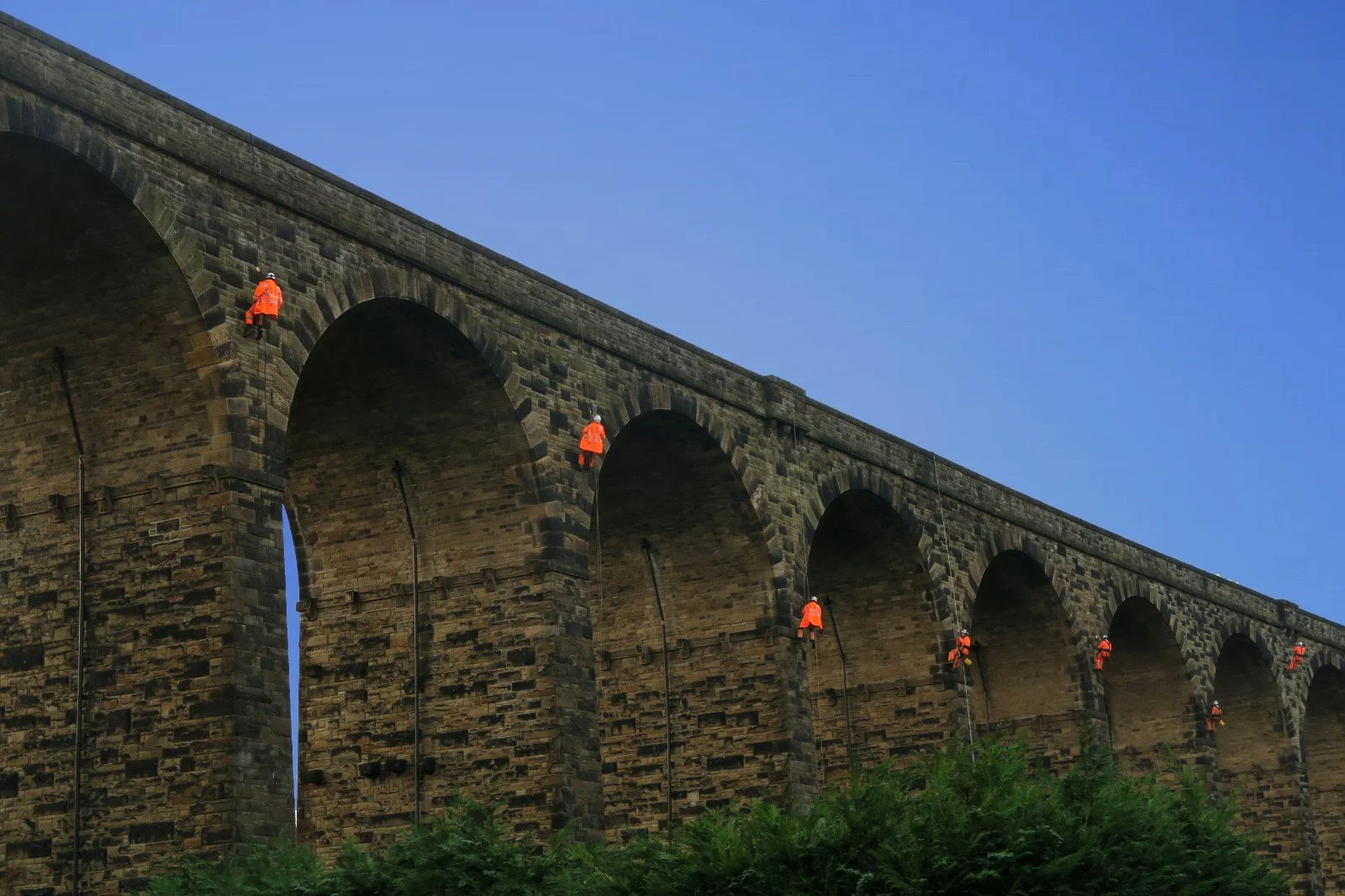
Enhanced Safety: Drastically reduces the need for hazardous human entry, rope access, or expensive scaffolding, protecting your personnel and the public.
Reduced Costs: Minimises the requirement for heavy machinery, extensive traffic management, and prolonged on-site hours, leading to significant cost savings.
Minimal Disruption: Many surveys, especially with our advanced LiDAR capabilities, can be conducted without the need for full lane closures or shutdowns of critical infrastructure like railways or highways.
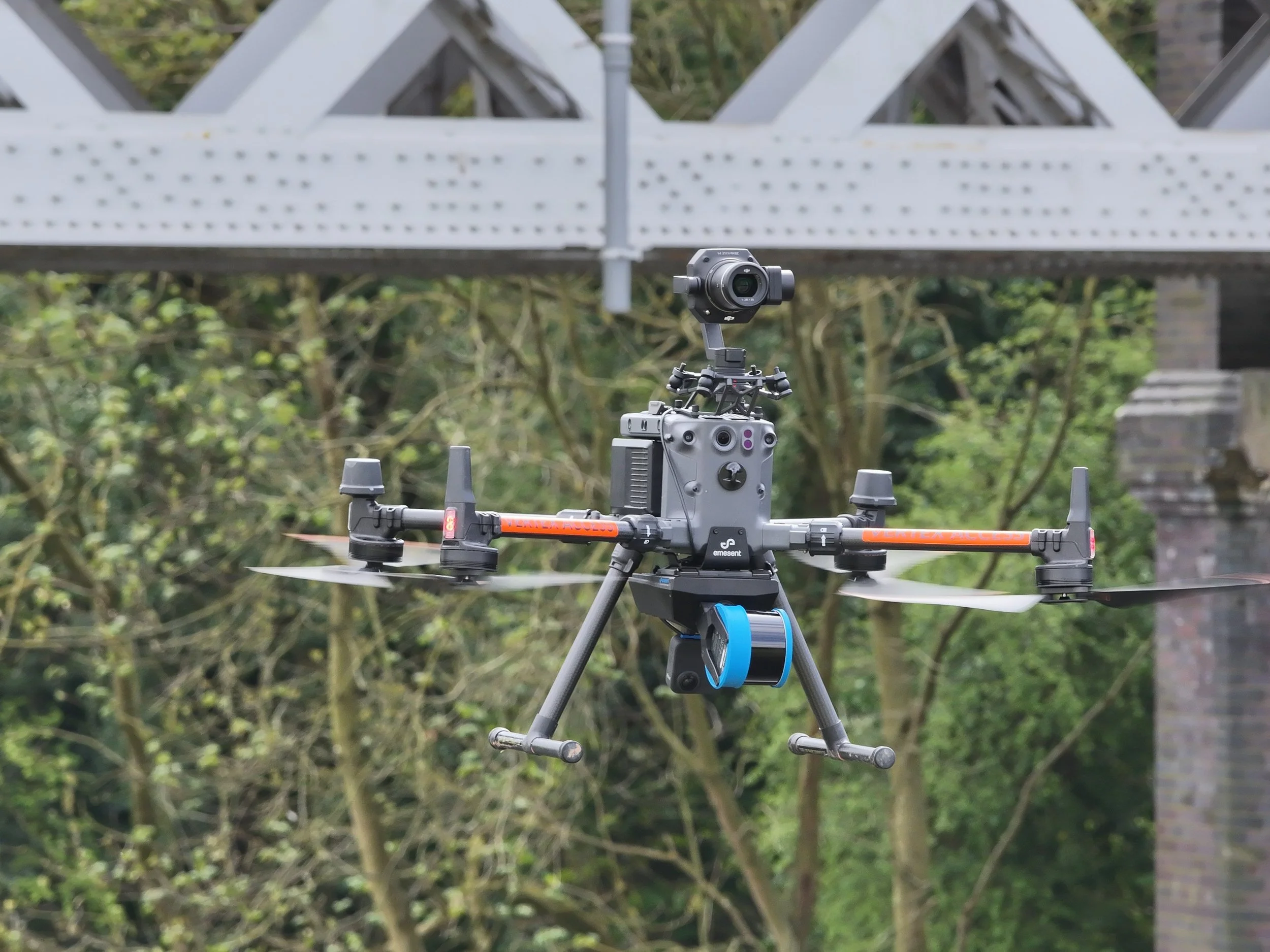
Superior Data Quality: Capture high-resolution imagery, precise measurements, and comprehensive 3D models of entire structures, including hard-to-reach areas. Our drones utilise powerful spotlights for illuminating poorly lit sections and advanced hybrid zoom cameras to capture minute details and defects from a safe standoff distance, ensuring superior survey data.
Increased Efficiency: Rapid deployment and data acquisition mean quicker turnaround times for inspection reports and deliverables.
Comprehensive Coverage: Drones can access and inspect areas that are challenging or impossible for human inspectors, such as complex undersides, high elevations, and internal voids.
LiDAR Mapping & Visual Inspection
Get in touch with us to discuss your bridge survey needs.
Our Comprehensive Drone Bridge Survey Services
High-Quality Inspection Surveys
Our drones, equipped with high-resolution cameras, powerful onboard spotlights, and advanced hybrid zoom capabilities, capture exceptionally detailed visual data of bridge components, even in challenging lighting conditions or at significant distances. We can provide:
Superior Detail Imagery: Crisp, clear photographs and video footage, allowing for thorough visual assessments and the identification of even subtle defects.
Detailed Condition Reports: Comprehensive reports identifying defects, deterioration, and areas requiring attention, compiled by experienced professionals based on rich visual data.
LiDAR Surveys
Utilising the state-of-the-art drone-mounted Hovermap ST-X LiDAR scanner, Vertex Access excels in capturing highly accurate 3D point cloud data. This technology is particularly effective for:
Complex Geometries: Accurately mapping the underside, elevations, and topside of bridges where traditional methods and other drone LiDAR scanners struggle.
Surveys Without Shutdowns: Significantly reducing or eliminating the need to close critical infrastructure during the survey process.
CAD Drawings & BIM Models: Delivering precise 2D CAD drawings and 3D Building Information Models (BIM) derived from the LiDAR data for engineering analysis, design, and as-built verification.
Detailed Photogrammetry Services
We create precise, high-resolution 3D photogrammetry models of bridges, offering invaluable tools for:
Virtual Planning & Design: Facilitating desktop reviews, virtual site visits, and planning for maintenance or retrofitting works.
Accurate Measurements: Enabling precise measurements of distances, areas, and volumes directly from the 3D model.
Geo-Located Inspection Images: Syncing high-quality inspection images to the 3D model, providing a spatially referenced visual record of defects and conditions.
Specialised Internal & Close-Proximity Surveys
Using our Elios 3 confined space drone, Vertex Access can safely and efficiently inspect areas previously deemed inaccessible or too hazardous:
Internal Bridge Voids: Thoroughly inspect internal chambers, box girders, and other enclosed spaces without human entry.
Critical Component Inspection: Get up close to vital elements like bearings, joints, and connections where traditional drones cannot safely operate, providing unparalleled visual data for condition assessment.

Confined Space Drone for Steelwork Inspection
Diverse Applications & Extensive Experience
Vertex Access has a proven track record of delivering exceptional drone bridge surveys across a wide range of applications and industries. Our extensive experience includes:
Pipe Bridges: Assessing structural integrity and support systems even in remote and traditionally inaccessible locations.
Rail Bridges: Providing detailed inspections with minimal disruption to operational rail lines backed with the knowledge of our specialist team Vertex Rail & Road.
Highways Bridges: Conducting surveys for structural assessments, maintenance planning, and asset management.
Heritage Bridges: Capturing detailed data for conservation and restoration projects on architecturally sensitive structures.
Public Footway Bridges: Ensuring the safety and serviceability of pedestrian and cyclist infrastructure.
Our team possesses in-depth knowledge of bridge architecture and the specific challenges associated with surveying these vital structures.

LiDAR Model for Referencing Defects
Learn more about our specialist Rail & Highways division here.
Why Choose Vertex for Your Bridge Survey Needs?
Specialised Expertise: We are not just drone pilots; we are survey and inspection professionals with specific expertise in bridge structures.
Cutting-Edge Technology: We invest in the latest drone platforms and sensor technology, including spotlights, hybrid zoom cameras, Hovermap ST-X, and Elios 3, to deliver superior results.
Actionable Data: We provide clear, concise, and accurate data that empowers informed decision-making.
Safety First: Our operations are conducted with the highest regard for safety, adhering to all aviation and site-specific regulations.
Efficiency & Reliability: We are committed to delivering projects on time and within budget, providing reliable data you can trust.

Pipe Bridge Photogrammetry Model Data Collection
Integrated Solutions: From Inspection to Remediation with the Vertex Group
Beyond providing industry-leading drone surveys, Vertex Access is part of a wider group of specialist companies. This allows us to offer a truly comprehensive solution for your bridge assets. Should your drone survey identify areas requiring attention, our sister companies, Vertex Rope Access and Vertex Rail and Road, collaborate to deliver a seamless inspection-to-remediation pathway. Vertex Rope Access provides expert, safe, and efficient access to even the most challenging locations on any bridge structure using advanced rope access techniques. This specialist access capability perfectly complements Vertex Rail and Road's expertise in executing targeted maintenance and repair works directly on rail and road bridge infrastructure. Together, they form a powerful synergy, ensuring that any findings from our drone inspections can be swiftly and effectively addressed with high-quality, hands-on maintenance and repair services, offering you a complete, end-to-end asset care package.
This integrated approach means we can facilitate a smooth transition from detailed inspection and data capture to practical, effective remedial action, all managed with the Vertex commitment to quality and safety.
Vertex Rail and Road Rope Access Remedial Works
Not What You Are Looking For?
Click below to see all of our drone services or get in contact with us to discuss your project needs
